

Traverse of the Alps by bike : 5 days, 14 climbs, from Thonon-les-Bains to Nice
Cycling from Thonon-les-Bains to Nice broadly follows the Route des Grandes Alpes, one of Europe’s most complete cycling routes: roughly 700 km and around fifteen mountain passes between Lake Geneva and the Mediterranean. We chose to complete it in 5 days, leaving out the Col de Feu and Col de Joux Plane on day one, which still meant solid stages of between 99 and 162 km per day, with elevation gain regularly climbing above 3,000 m.
We got there by train from Annecy to Thonon-les-Bains, and hit the road straight out of the station.
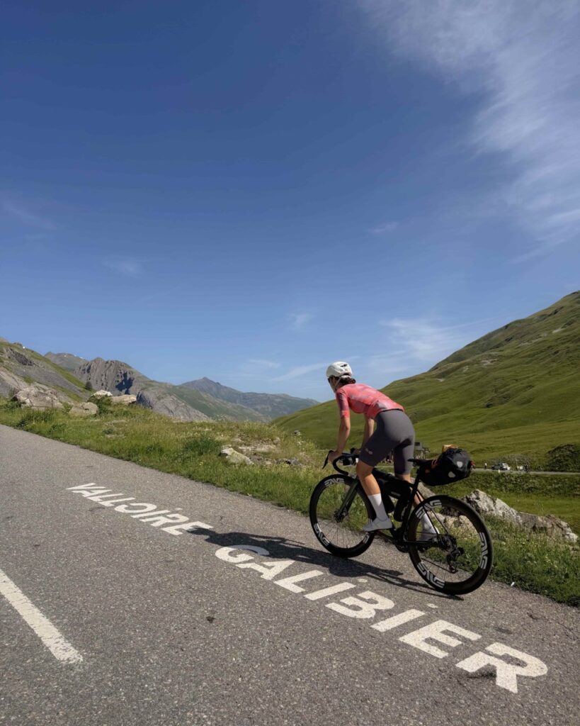
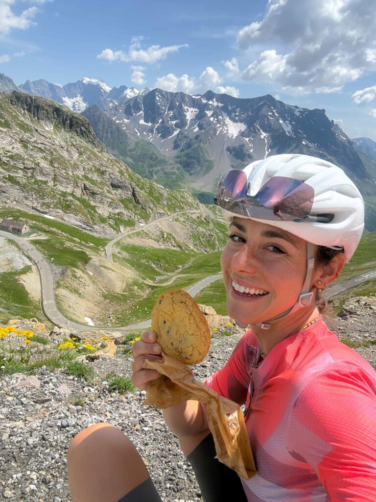
Table of Contents
Day 1 — Thonon-les-Bains → Arêches : 150 km, 3760 m D+
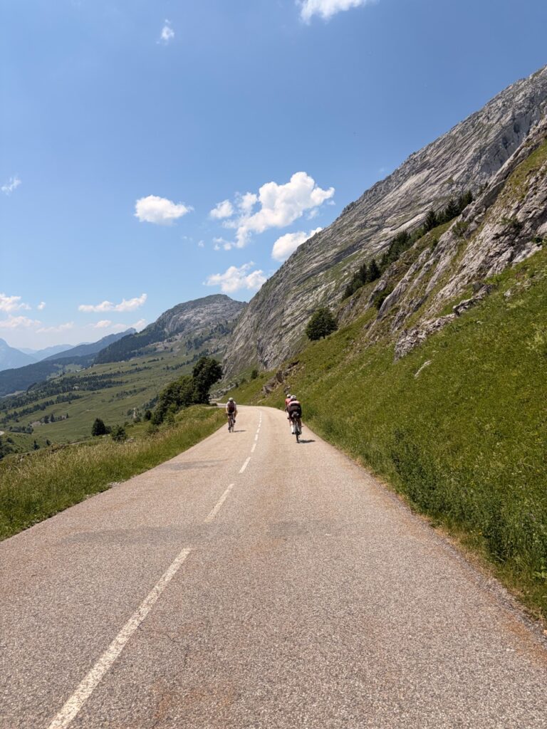
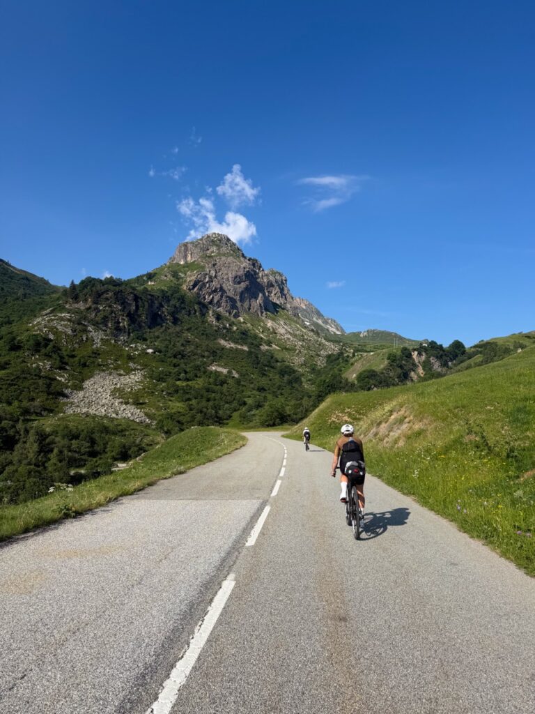
Col de la Colombière (northeast side from Scionzier: 17.3 km, 1,127 m elevation gain, summit at 1,613 m) kicks things off. This is the one that stayed with me as the hardest of the whole week: full sun from start to finish, not an inch of shade, with a final stretch that ramps up seriously in the last two kilometers.
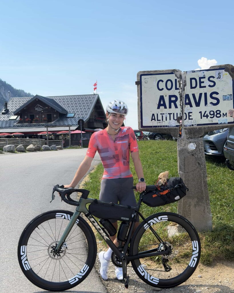
Next up was the Col des Aravis (from the Saint-Jean-de-Sixt junction: 10.3 km, 527 m elevation gain, summit at 1,486 m), with a strategic stop at the supermarket right before the climb, deep in Savoie, the fountains were dry, so we had to stock up on bottles before tackling it.
The Col des Saisies (Flumet side: 14.6 km, 788 m elevation gain, summit at 1,657 m) closes out the day’s climbs, with a particularly enjoyable, smooth-rolling descent. But the stage doesn’t end at the pass. There’s still the final climb back up to Arêches, with an extra 250 m of elevation gain landing at the worst possible time, legs already emptied after 150 km.
Where to stay: Le Christiania, in Arêches (other options spotted on-site: Hôtel du Grand Mont, Maison d’Oron, Hôtel la Roche).
For supplies, the Boulangerie Pâtisserie Pouilloux in Beaufort is a must for the next morning. There’s also somewhere to stock up in Saint-Jean-de-Sixt.
Day 2 — Arêches → Modane : 150 km, 3500 m D+
Only two passes on the program but two substantial climbs, more due to their length, the Iseran especially, than their steepness.
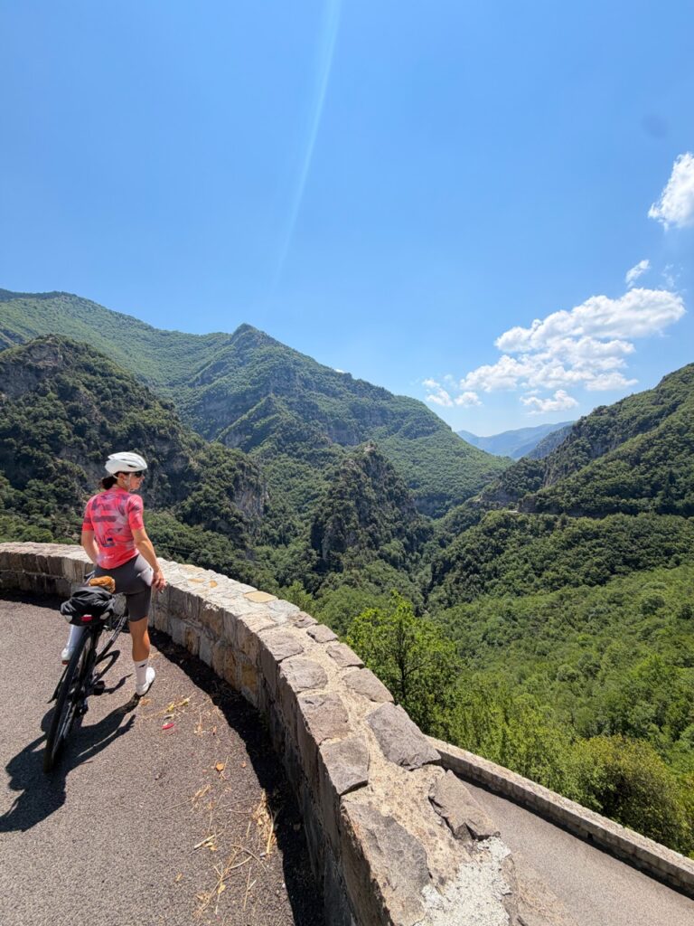
The Cormet de Roselend (Beaufort side: 20.3 km, 1,230 m elevation gain, summit at 1,968 m) starts out unremarkably, before the Col de Méraillet reveals Lake Roselend, one of the most beautiful stretches of the whole trip. The descent changes character along the way. Gorgeous at first, then more technical through the trees down to Bourg-Saint-Maurice, with a pothole-riddled road and tighter hairpins that shouldn’t be taken lightly.
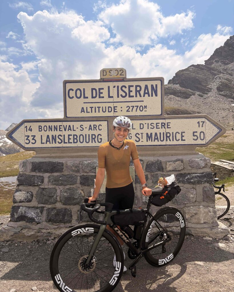
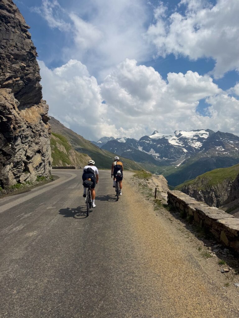
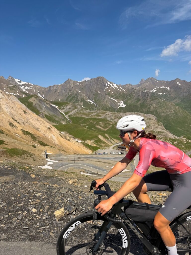
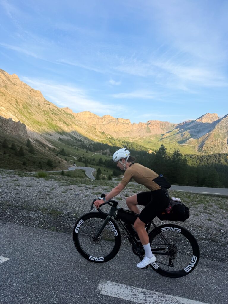
A required stop next in Séez, where the Boulangerie 3G is well worth the detour. Then begins the long, very long climb up the Col de l’Iseran (Bourg-Saint-Maurice side, via Val d’Isère: 47.5 km, roughly 2,034 m of cumulative elevation gain, summit at 2,770 m). The only real break on this side is while passing through Val d’Isère, with another bakery stop at Maison Chevallot. From there, it’s still 16 km and 929 m of elevation gain to the summit, the highest paved pass in France. After that, a long, magnificent descent toward Modane, cut short by a flat stretch that’s anything but restful at the end of the day.
Where to stay: Hôtel le Commerce, Modane.
Bakeries not to miss: Boulangerie 3G (Séez) and Maison Chevallot (Val d’Isère).
Day 3 — Modane → Cervières : 99 km, 2640 m D+
Three passes, and one of the most beautiful sequences of the whole trip.
The Col du Télégraphe (Saint-Michel-de-Maurienne side: 11.8 km, 851 m elevation gain, summit at 1,566 m) serves as a serious but manageable leg-warmer. A well-earned stop in Valloire at Le Fournil des Bergers – Boulangerie Folliet, before tackling the main climb.
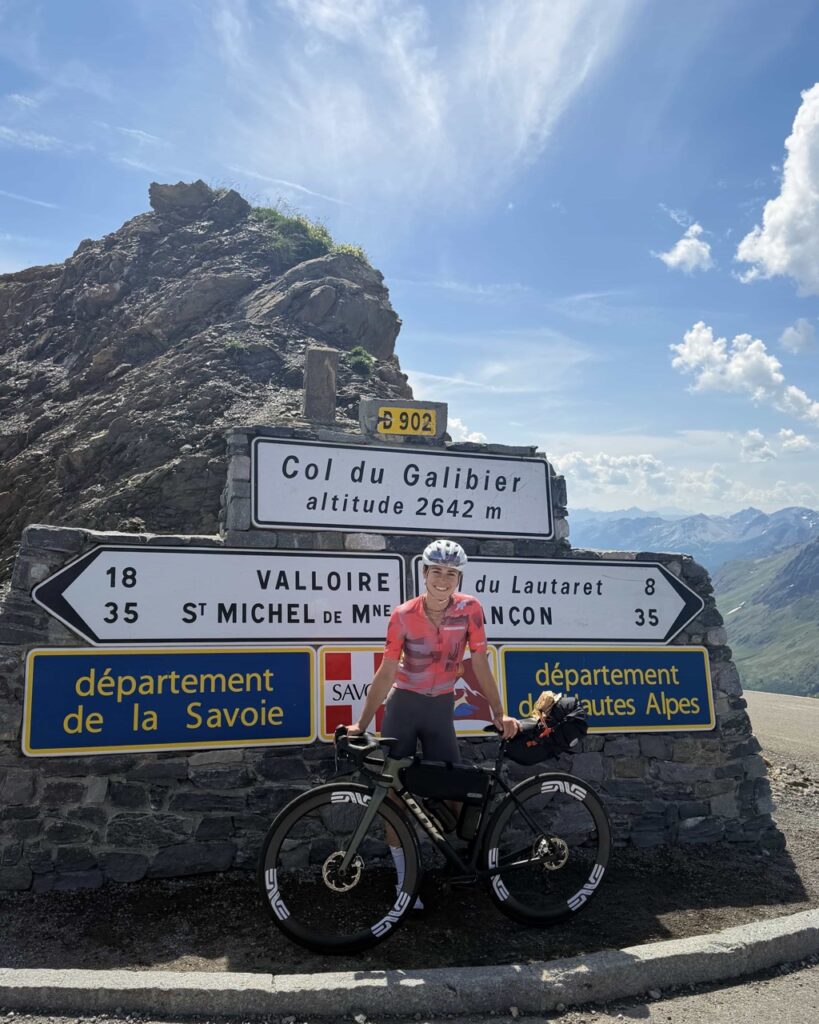
The Col du Galibier (from Valloire: 18.2 km, 1,237 m elevation gain, summit at 2,642 m) remains one of the most beautiful passes of the entire crossing. Water refill, plus a restorative little Coke, at the Auberge de Plan Lachat. Lucky timing that day, the pass was closed to motorized traffic from 9 am to 12 pm. The passes reserved for cyclists change daily in France during summer, so it’s worth checking the calendar before you go.
Next stop, the Col d’Izoard, but the weather had other plans. Black clouds, an approaching storm. We stopped in Cervières, on the first part of the north side (Briançon side: roughly 9.5 km, 400 m elevation gain up to Cervières, at 1,610 m), at the last inn before the Refuge Napoléon. There were still 600 m of elevation gain left to reach the summit and continue on to Guillestre, the day’s original destination, that would have to wait until the next morning.
Where to stay: Auberge l’Arpelin, Cervières, nearly full that night, but one last room was available. Original stop Guillestre – Hôtel le Catinat Fleuri, or other options on Booking; gîtes and B&Bs are also worth checking, sometimes a great way to save money without sacrificing comfort.
Bakery: Le Fournil des Bergers – Boulangerie Folliet, in Valloire.
Day 4 — Cervières → Saint-Étienne-de-Tinée : 129 km, 3410 m D+
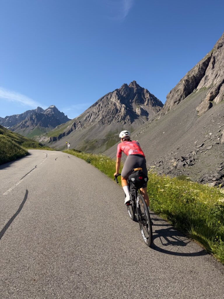
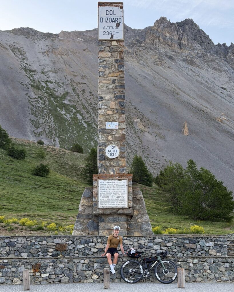
Sunrise over Cervières, one of the most beautiful memories of the trip. The final stretch of the Izoard (Cervières → summit: roughly 8 km, 600 m elevation gain, summit at 2,360 m) lives up to its reputation: one of the most beautiful passes of the whole crossing.
A freezing descent down to Guillestre, with a mandatory detour to the Boulangerie Artisanale, the braided brioche I bought there stayed with me, and fueled me for three days in my saddlebag.
Then a long stretch of gently descending false flat through magnificent gorges, with little traffic in the morning, before tackling the Col de Vars (Guillestre side: 19.4 km, 1,111 m elevation gain, summit at 2,108 m). A descent follows down to the foot of the Bonette, the toughest chunk of the day.
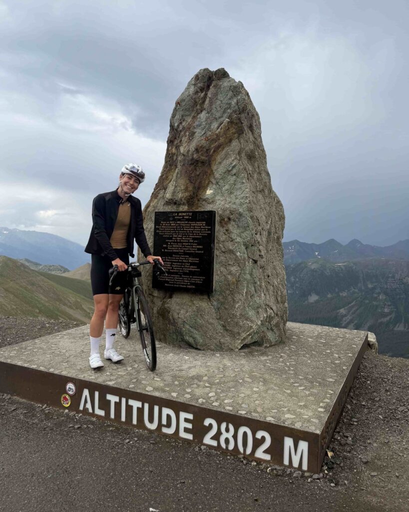
The Col de la Bonette, all the way to the Cime (Jausiers side: 24 km, 1,589 m elevation gain, summit at 2,802 m), came down to a weather window: a threatening cloud hung over the summit, but the forecast called for a clear enough spell to attempt the climb. It’s actually the highest paved road in Europe connecting two valleys a title sometimes disputed by other dead-end high-altitude roads (like Spain’s Pico Veleta), but the Bonette remains the reference for this kind of valley-to-valley route. A magnificent descent despite the cold and clouds down to Saint-Étienne-de-Tinée, a pretty village where a last-minute Booking reservation saved the evening. To get closer to the start of the Col de Saint-Martin, it’s also possible to push on to Isola or Saint-Sauveur-sur-Tinée, though accommodation gets scarcer there on short notice.
Day 5 — Saint-Étienne-de-Tinée → Nice : 162 km, 3140 m D+
The longest stage, and the one with the most passes.
30 km of easy warm-up in the cool morning air to reach the foot of the Col de Saint-Martin / La Colmiane (Vallée de Tinée side: 16.5 km, 1,023 m elevation gain, summit at 1,502 m), with a well-earned stop in Saint-Martin-Vésubie on the way down, at the bakery La Petite Suisse, that blueberry tart is one for the memory bank.
Well refueled, on to the Col de Turini (Vésubie valley side: 15.2 km, 1,104 m elevation gain, summit at 1,604 m), the very same pass the Monte Carlo Rally tackles every year. The descent that follows, through scenery that could give Avatar a run for its money, stands as one of the most beautiful of the whole trip.
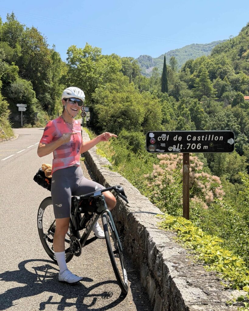
A stop in Sospel to eat and refill the bottles, before taking on the Col de Castillon (Sospel side: 7 km, 366 m elevation gain, summit at 706 m) and then the Col d’Èze (Menton side: 16.7 km, 541 m elevation gain, summit at 500 m). Right after Castillon, the sea finally appears on the horizon. The Col d’Èze, last of the series, is also the least enjoyable with a heavy traffic, but it’s the last one, and you can feel the finish line getting close.
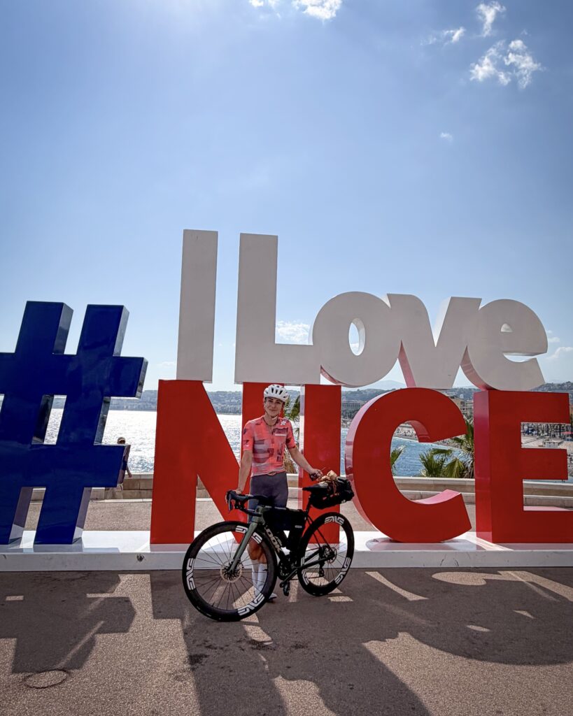
Arriving in Nice, after five days and 14 passes, brings an emotion that’s hard to put into words.
A crossing I’d strongly recommend doing at least once in a lifetime.
My gears/equipments for this trip
My bike :
- Frame – 785 Huez RS Look
- Crankset – SRAM Red AXS 50/37T
- Cassette – SRAM X1290 10-36T
- Wheels – SES 4.5 Enve
- Pneus – Blackbird Allseason Hutchinson 30mm
- Pedals – Kéo Blade Ceramic Vision Look
- Saddle – Vento argo r3 adaptive Fizik but I recommend the Vento Argo R1 Light
- Bottles – Twist Bottle 750M x 2 Fidlock
- A second cycling kit (Full kit)
- Microfiber towel
- Swimsuit
- Flip-flops
- Shorts et t-shirt (evening outfit)
- Toiletry bag + a few emergency medications
- Energy drinks for the whole trip
- Extra bars and gels
- Merino long-sleeve base layer
- Rain jacket
Ortlieb Frame-pack toptube, 3L
- Chargers (phone + electronic transmission)
- Power bank
- Sunscreen
- Anti-chafing cream (essential over 5 days in a row)
- Multitool
- Pump
- Inner tube
- Mèches puncture repair
- Wallet with some cash
- Bars et gels
What I wish I’d had: gloves to protect my hands on descents. A pair of leg warmers and arm warmers would also have been nice to have, despite the heatwave, storms are more frequent at altitude than you’d think.
Where to sleep: how we chose
- Booking ahead vs. last minute: Booking as you go keeps your pace flexible, but comes with the risk of finding no vacancy in peak season, like in Beaufort, where we had to push on to Arêches for lack of a room. An effective compromise is booking the night before for the next stop, once the day’s stage is nearly wrapped up and you have a rough arrival time. We rode the crossing from June 27 to July 2.
- Sleeping right before a pass rather than after: Spending the night at the foot of a big climb lets you tackle it cold, with fresh legs and often milder weather in the morning. But “at the foot” doesn’t necessarily mean immediately at the base: sleeping 20-30 km before, if the terrain is flat or gently descending, lets you warm up steadily while riding before hitting the slope, rather than starting cold straight into the climb. It’s also a way to split an otherwise-too-long stage into two more manageable parts, without losing momentum on the overall schedule.
- Always have a backup plan in peak season: In July and August, small Alpine villages fill up fast, especially on weekends or during local events. Scouting two or three fallback options within a 10-15 km radius ahead of time saves you the stress of an unfindable room at the end of the day.
Refueling: one of the most important part
- Bakeries as strategic checkpoints: On this crossing, village bakeries acted as real refueling stops, often more reliable than a supermarket in the middle of the mountains. It’s worth scouting out ahead of time which ones sit right on your route, ideally just before a big climb.
- Fountains: don’t count on them everywhere. In Savoie especially, several fountains were closed or shut off, forcing us to top up on water in advance, before heading into more isolated areas. The rule we adopted: fill your bottles as soon as a reliable water point shows up, rather than waiting until you’re running dry.
- What to carry for self-sufficiency between villages: Between refueling stops, it’s best to always keep a reserve of bars, pastries, or a sandwich to avoid hitting the wall mid-climb, especially on passes longer than 15 km. On the water front, plan generously in summer for long climbs like the Iseran or the Bonette, where there may not be a water point for over an hour of climbing.
General logistic of the trip
- How we split up the stages: Choosing to do it in 5 days meant demanding stages, between 99 and 162 km with daily elevation gain often exceeding 3,000 m. It’s a pace that requires solid fitness, but one that lets you complete the crossing within a week off work without stretching it out too much.
- The train to reach the starting point: Taking the train from Annecy to Thonon-les-Bains let us start riding straight out of the station, with no car logistics to deal with. It’s a simple option for this kind of linear route, avoiding the hassle of having to go back for a vehicle at the other end of the trip.
- The return from Nice: We took the train back the day after arriving, which left an evening to catch our breath and celebrate the end of the trip on the spot.
The weather
- How we tracked the weather day by day: We used météociel.com to check the forecasts. We also asked the locals.
- The calls made at the Izoard and the Bonette: On both of these passes, the same logic applied: watch the clouds and the weather window rather than charging in blindly. That meant an early stop in Cervières one time, and a carefully timed start the other, to catch the dry window before the storm on the Bonette.
- Best time of year to attempt this crossing: The big passes above 2,000 m, like the Iseran or the Bonette, are generally only open between June and October, depending on snowfall. Aiming for July-August maximizes your chances of finding all the roads clear, at the cost of heavier traffic on the touristy stretches.
- Gearing up for the valley-to-summit temperature swing: With over 2,000 m of elevation gain on some days, the temperature difference between the valley floor and the summit can top 15°C, not counting wind chill at altitude. A lightweight rain jacket and arm warmers tucked in the saddlebag are usually enough to get over the summits without freezing on the descent.
Budget / duration / level required
- Physical level required (in 5days): This kind of crossing requires having already done long rides and knowing your own limits well, especially in hot weather. Managing your effort and hydration matters as much as your legs. You also need to be comfortable riding in traffic and know how to descend, since some descents can be steep and technical. The upside is that the effort is spread out over the whole day: you stay mostly in zone 2, which doesn’t wreck your muscles too much as long as you avoid unnecessary surges. The weight of the saddlebags, on the other hand, affects your pace, and your knees can start to ache by the end of the day from repeated strain under that load.
- Budget range for accommodation + food: Splitting the cost between two people, expect around 50€ for a night’s accommodation. For food, small stops along the way generally run 10-15€ per person, and dinner in the evening around 25€ per person.
- Best window of dates in summer: July remains a good compromise between open passes, long daylight hours, and still-reasonable crowds, before the August peak on routes like the Route des Grandes Alpes. We started every morning between 5:30 and 6:00 am to make the most of the cool morning window.
- Train budget from Annecy and back from Nice, by TER:
- Annecy → Thonon-les-Bains: around 13€
- Nice → Annecy: around 115€
At a glance
| Itinerary | Thonon-les-Bains → Nice |
| Duration | 5 days |
| Total distance | ~690 km |
| Total elevation gain | ~16 450 m |
| Nunmber of passes | 14 |
| Longest stage | Day 5, 162 km / 3100 m D+ |
| Shortest stage | Day 3, 99 km / 2600 m D+ |
| Highest point | Cime de la Bonette, 2802 m |
| Best season | Beginning of June/July |
| Level required | Experienced cyclist, comfortable descending |
| Estimated budget / day / person | ~100€ accommodation (à 2) + 35-40€ food |
Five days earlier, sweating through the switchbacks of the Colombière, the sea felt a thousand miles away. I hope this story makes you want to see it appear for yourself, at the top of the Col d’Èze. Make the most of every stage, and don’t hesitate to share your own experience in the comments 🙂
1 comment
Thanks Kim for writing all the details – very informative!
And impressive ride!
I am eyeing for some French Alps this year (as I cycled my Swiss passed through and through already) and what worries me are 2 things – bike transport in trains and hotels…I think that for the first year I will book something in one place for a few nights and cycle around to get accustomed to, and your ride will be a big plan for next year.